Inspections services of aging infrastructure using Drone Technology
Overview
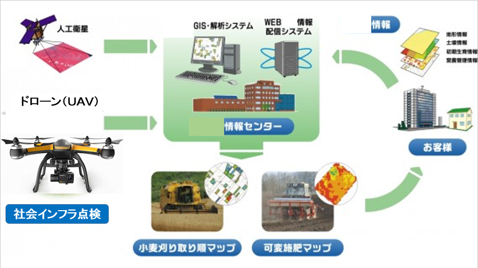
We will develop Agricultural Support System in order to achieve the transition to a precision agriculture based on 'Objective data' rather than 'Intuition and Experience' We will provide Agricultural Information which is necessary for Farmers That is, Agricultural Support System using Remote Sensing or GIS. We will develop high-precision farming support map created from captured images by UAV and sale it.
Background
Large-scale farmers of 50ha over or the same scale agricultural production corporation are increasing. Conversion of agriculture into Agriculture that is based on objective data which is able to share the information from 'intuition and experience', are needed.
Development Project
1. Technological development of agricultural support system
Remote sensing for soil and crops of the measurement system, analysis system of measurement
data that is the core of the GIS, the realization of agricultural information delivery by WEB.
2. Technological development of Map of agricultural support
Soil component map by satellite images, high-precision farming support map by the fusion of
satellite images and aerial for UAV image, farming support map by the UAV and geographic
information and initial growth information for Aerial.